Key App Features:
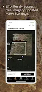
- Crystal-Clear Imagery: Experience resolutions as sharp as 30 cm, providing unparalleled detail for any global location.
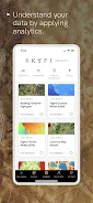
- Robust Analytics Toolkit: Utilize a suite of analytical tools including building detection, DEM, NDVI, and more, layering insights directly onto imagery for enhanced understanding.
- Effortless Ordering: Intuitive navigation makes ordering easy for everyone. Define your area, select an image (existing or new), choose your sensor, and seamlessly integrate with your existing workflow.
- Diverse Applications: SkyFi caters to various needs, including remote location and infrastructure monitoring, informed business decisions, environmental change tracking, preserving cherished locations, property vetting, exploring hard-to-reach areas, and even creating unique gifts.
- Cross-Platform Access: Enjoy seamless access on smartphones, tablets, and computers, ensuring data is always at your fingertips.
- Constantly Expanding Network: SkyFi continuously adds new satellite, aerial, and analytics providers, guaranteeing access to the latest and most relevant data.
In short, SkyFi is a powerful and user-friendly app providing high-resolution imagery, comprehensive analytics, and streamlined ordering. Its versatility and cross-platform compatibility make it ideal for both professional and personal use. Download SkyFi now and unlock a world of Earth observation possibilities!